03
NOV
2017

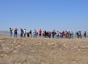
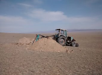
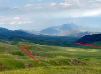
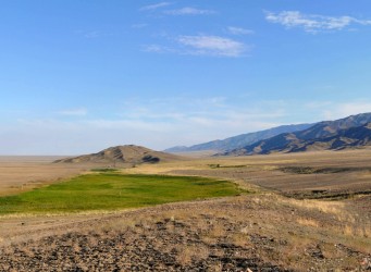
When was the last major earthquake on the Main Kopeh Dagh Fault in Turkmenistan?

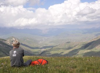
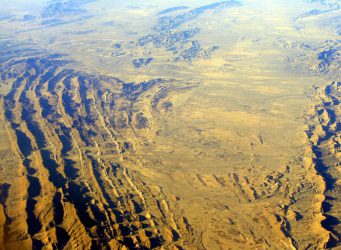
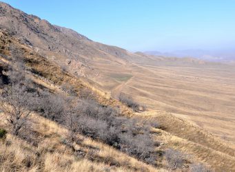
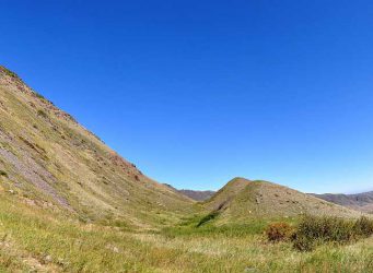
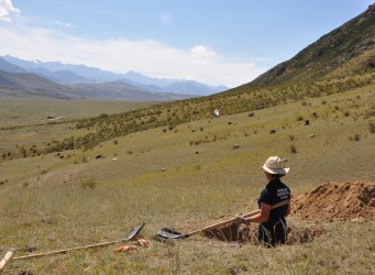
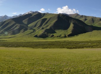
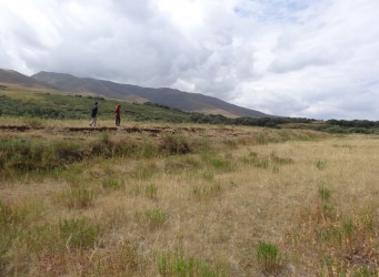
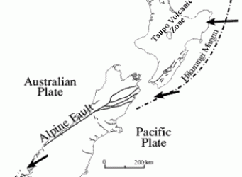
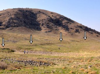
The Main Kopeh Dagh Fault in Turkmenistan is more than impressive. It’s a NW-SE trending right-lateral strike-slip fault with a wonderful morphological expression that can be traced for several hundreds of kilometres. This fault marks the northernmost deformation front of...
06
SEP
2017

Field work in Central Kyrgyzstan

Our past field work campaigns in Kyrgyzstan and Kazakhstan focussed rather on the northern edges of the Tien Shan because we wanted to understand, among other things, where the deformation front is and how deformation propagates into the forelands. In our most recent trip to...
12
MAY
2017

The rapidly populating coastal region from the Gulf to Pakistan faces a huge tsunami risk

  Camilla Penney, University of Cambridge   That tsunamis can cause death and devastation has become painfully clear over the past two decades. On Boxing Day, 2004, a magnitude 9 earthquake off the coast of Sumatra caused waves several metres high to devastate the...
22
MAR
2017

Active faulting and great earthquakes – field work in Turkmenistan

Turkmenistan hosts one of the most spectacular faults in Central Asia. The Ashgabat Fault is a more than 300 km long strike-slip feature with a significant vertical component of motion and a remarkable expression in the landscape. Ashgabat, Turkmenistan’s capital, is...
05
MAR
2017

The 2016 field work campaign on the Dzhungarian Fault

In 2015, an EwF team went out for field work in the northern Tien Shan to investigate the slip rate of the Dzhungarian Fault (read the article here). Based on the new findings, we ran another field campaign on this major strike-slip fault in summer 2016. This time we focussed on...
18
JAN
2017

Report on the conference “Earthquake science and hazard in Central Asia”

From 7-11 September, 2016, the conference “Earthquake science and hazard in Central Asia” took place in Almaty, Kazakhstan. The meeting brought together earth scientists and social scientists from the EwF project, and scientists and decision makers from Kazakhstan....
01
DEC
2016

New EwF-paper on faults in continental interiors: Palaeoseismic insights from SE Kazakhstan

In 2014 an EwF team investigated active faults in southeast Kazakhstan. We focussed on the area around the Ili Basin because we already knew that active tectonics were forming the landscape there and we wanted to find out which of the many faults are the most active ones. This...
15
OCT
2016

Field work on the Chilik-Chon Kemin Fault in Kazakhstan

The Chilik-Chon Kemin Fault in Kazakhstan caused one of the largest continental earthquakes ever recorded. In 1889, an earthquake with an estimated magnitude of ~M8.3 occurred on this left-lateral strike-slip fault zone and produced more than 100 km of surface ruptures...
20
JUL
2016

Field work campaign on faults and earthquakes in Kazakhstan and Kyrgyzstan

One focus of EwF is to investigate the active faults in the Tien Shan. We map them from satellite data and in the field, we measure their slip rates, and we reconstruct their earthquake history. These studies help us to understand how the continents deform. The data we gather can...
16
JUN
2016

New paper on earthquake science in DRR policy and practice

Background: one of our priorities in the Earthquakes without Frontiers project has been to understand how earthquake science is used in disaster risk reduction (DRR) efforts across the partnership countries. To what extent are DRR activities informed by, or underpinned by,...
15
JUN
2016

Landslides following the 2015 Gorkha earthquake: Monsoon 2016

  Observations The 2015 Gorkha earthquakes triggered more than 22,500 landslides, focused along the major river valleys in the hill and mountain districts of central and western Nepal, and were equivalent to several hundred years of ‘normal’ monsoon-triggered landslide...
25
MAY
2016

New EwF paper on the 1889 Chilik Earthquake (Mw8.0-8.3) in the Tien Shan

One of the focus areas of the EwF project is the Tien Shan, especially the northern part of the mountain range in Kyrgyzstan and Kazakhstan. Here we can study how the continents deform as a far-field effect of the convergence between India and Eurasia. We investigate how the...
04
APR
2016

COMET Topography Workshop in Oxford

Oxford University kindly hosted the COMET Topography Workshop from 31 March to 1 April, 2016. The workshop was all about high-resolution topography data derived from stereo satellite imagery and Structure-from-Motion. Aim was to provide practical training with the ERDAS Imagine...
20
JAN
2016

Field work on the Dzhungarian Fault in Kazakhstan

The Tien Shan in Central Asia is one of the largest mountain belts on Earth, stretching for more than 1500 km. Its ongoing deformation is driven by the collision of India with Eurasia. Some of the strongest intracontinental earthquakes that we know about have hit the region...
22
NOV
2015

Field work in the epicentral area of the 1889 Chilik Earthquake, Kazakhstan

A series of great earthquakes struck the northern Tien Shan around one century ago. In 1887, an earthquake (M>7) flattened the city of Verny, today’s Almaty. One of the strongest continental quakes that we know about hit two years later. With a magnitude of ~M8.3 the...
14
OCT
2015

Field work in Kyrgyzstan

In June 2015 an EwF team of UK and Kyrgyz scientists went to Kyrgyzstan to conduct field work in the Suusamyr valley. An earthquake of magnitude MS7.3 happened there in 1992, leaving more than 70 people dead. Several aftershocks exceeded magnitude 6. This thrust earthquake is...
30
JUN
2015

UPDATED (30 June) landslide inventory following 25 April and 12 May Nepal earthquakes

Please note: this is an updated landslide density map that includes, for the first time, landslides triggered by both the 25 April 2015 Gorkha earthquake and the 12 May 2015 Dolakha earthquake. It should be read in conjunction with previous posts on the effects of the 25 April...
28
MAY
2015

Nepal: UPDATED (28 May) landslide inventory following 25 April Nepal earthquake

Please note: This is an updated landslide density map following the 25 April earthquake in Nepal. The inventory does not yet include failures triggered or reactivated by the 12 May 2015 earthquake.  Key messages (all observations based on available cloud free satellite imagery):...
12
MAY
2015

Nepal: update on landslide hazard following 12 May 2015 earthquake

British Geological Survey and Durham University 11:20 BST Tuesday 12 May 2015   Key messages (all observations based on available cloud free satellite imagery) The large earthquakes on 12 May occurred directly beneath the area that suffered the largest impacts from...
10
MAY
2015

Landslides in the Nepal earthquake: preliminary guidelines for relief and response activities from 28 April in Nepali – नेपालमा भूकम्प र भूकम्पजनित पहिरो : राहत र प्रतिकार्य गतिविधिका लागि तयार गरिएको प्रारम्भिक निर्देशिका

सीमारहित भूकम्प परियोजना – Earthquake Without Frontiers – 28 April 2015 With thanks to Gopi K. Basyal, NSET-Nepal for translating this post.    गत अप्रिल २५, २०१५ मा गएको भूकम्पले गर्दा ठॉउ ठॉउमा पहिरोका घटना र त्यसको असरहरु प्रष्ट रुपमा देख्न सकिन्छ ...
08
MAY
2015

Nepal earthquake: update on landslide hazard (8 May)

British Geological Survey, Durham University, ICIMOD, NASA, and University of Arizona Please note: A higher-resolution version of the map, and black-and-white versions, are available from: ftp://topdog.dur.ac.uk/njr/nepal_eq/UPDATE_20150508/   Key messages (all observations...
05
MAY
2015

Nepal earthquake: update on landslide hazard

British Geological Survey, Durham University & University of East Anglia 1200 BST Tuesday 5 May 2015 **PLEASE NOTE: THIS MAP WAS UPDATED ON 8 MAY 2015. THE UPDATED MAP CAN BE ACCESSED HERE: http://ewf.nerc.ac.uk/2015/05/08/nepal-earthquake-update-on-landslide-hazard-2/ **...
29
APR
2015

Building rural resilience to earthquakes

Katie Oven, Sam Jones, Alex Densmore and Dave Milledge Just over a week ago, in a remote village in Dhankuta District in eastern Nepal, members of the EwF team were exploring with community members the actions that can be taken to make the community safer from earthquakes and...
28
APR
2015

Landslides in the Nepal earthquake: preliminary guidelines for relief and response activities

Alex Densmore, David Milledge, David Petley, Nick Rosser, and Katie Oven The extent and effects of landsliding triggered by the 25 April 2015 Nepal earthquake remain unclear. However, since relief and response activities have already begun, and will accelerate in the coming days,...
25
APR
2015

Nepal earthquake: likely areas of landsliding

UPDATED 26 April 2015 to reflect new USGS ShakeMap results; this has resulted to some changes in the landslide susceptibility pattern in Tom Robinson’s model The Mw 7.9 Nepal earthquake on 25 April 2015 appears to have occurred on a shallowly north-dipping thrust fault...
01
DEC
2014

Resilience in China: EwF in Sichuan Province

Three members of the EwF team represented the project at a recent workshop in Chengdu, China, hosted by NERC, ESRC, and the National Natural Science Foundation of China (NSFC). The workshop brought together about 50 researchers from the UK and China, and was aimed at scoping out...
05
SEP
2014

A trip to the end of the world …

Our field seasons in central Asia have taken us to all kinds of remote and spectacular places, but nowhere really compares to the Alai valley of southern Kyrgyzstan. Here, the Tien Shan and Pamir, two of the greatest mountain ranges on Earth, come together across a narrow valley....
04
SEP
2014

LINES IN THE FANS

Tim Middleton describes some of the fieldwork for his PhD, sampling and mapping fault scarps from the 1739 Yinchuan earthquake in northern China. The terrain is hard-going. An undulating surface of large boulders stretches for kilometres in every direction; the vans are back by...
02
SEP
2014

New satellite maps out Napa Valley earthquake

A new Earth-observation satellite called Sentinel-1A has been used for the first time to map the ground movements caused by the magnitude 6 earthquake that shook up California’s wine-producing Napa Valley on 24 August 2014 (European Space Agency). The interferogram of the rupture...
02
SEP
2014

Earthquake-triggered landslides: what do we need to know?

One of the topics that has emerged as a major concern across the Earthquakes without Frontiers partnership during the first two years of the project is the problem of earthquake-triggered landslides. While it is well known that large earthquakes can trigger many thousands of...
18
JUN
2014

Fieldwork to Eastern Turkey

In October 2011 a magnitude 7.1 earthquake struck the cities of Van & Ecriş in Eastern Turkey killing over 600 people. Using satellite radar measurements, EwF scientists were able to precisely map the fault segments that ruptured in this event.. These observations were...
14
APR
2014

Snapping the Crust

A sudden release of energy and the snapping of the Earth’s crust can literally knock us off our feet. Earthquakes can also be responsible for landslides, tsunamis and sometimes volcanic activity. Thankfully, for most of us, quakes are likely to be the stuff of disaster...
27
MAR
2014

People Power

Kate Ravilious Data gathering needn’t always involve expensive instruments or exotic fieldtrips. Here in resource strapped Nepal, seismologists are tapping into the power of local people to collect information that could ultimately save many lives. In places like California...
27
FEB
2014

Why do we study earthquakes?

A review of the conference on “Earthquakes: from Mechanics to Mitigation”, organised by EwF and the British Geophysical Association (BGA), hosted by the Royal Astronomical Society and the Geological Society of London as part of their New Advances in Geophysics (NAG)...
07
DEC
2013

Building earthquake resilience in different governance contexts: initial reflections on some emerging themes

Jonathan Rigg, National University of Singapore & Katie Oven, Durham University We are now 18 months into our five-year Earthquake without Frontiers research programme which involves a dazzling number of researchers from the natural and social sciences, and around 20...
12
JUL
2013

EwF launch in China, and the M8 1556 Huaxian earthquake

By Yu Zhou (University of Oxford) This April, part of the EwF group (Professor Philip England, Professor Barry Parsons and Dr. Richard Walker from the University of Oxford; Professor Lena Dominelli and Dr. Katie Oven from Durham University; John Young from the Overseas...
01
MAY
2013

We are recruiting a post-doctoral researcher to work on earthquake-induced landslides

.. Professor Alex Densmore and I are currently recruiting a Post-Doctoral researcher to work with us on a project on earthquake-induced landslides. This post, which will start on 1st October 2013, is a two month position that is part of the consortium team on the ‘Earthquakes...
18
APR
2013

A first analysis of the potential landslide distribution from the Iran earthquake

By Rob Parker (University of Cardiff) and Dave Petley The Mw = 7.8 earthquake on Tuesday in Iran was the largest event in that country for about 50 years. Fortunately, the depth of the earthquake (82 km) and the low population density in the affected areas meant that loss of life...
22
JAN
2013

The EwF Launch in Kathmandu, Nepal

Katie Oven and Susanne Sargeant   January 16th saw the launch of the EwF project in Kathmandu, Nepal.  Hosted by the National Society for Earthquake Technology (NSET-Nepal), the event brought together more than 25 national-level stakeholders involved in earthquake risk reduction...
14
JAN
2013

The EwF Project Launch in Patna, Bihar State, India

“Punarnava”: Bouncing back to life again and again Samantha Jones and Katie Oven The EwF launch in Patna, in the Indian State of Bihar, took place this week.  Hosted by the Bihar State Disaster Management Authority, the launch was attended by 25 stakeholders involved in...
21
DEC
2012

Active faults in northern China and some rather cold fieldwork

By Tim Middleton, PhD student at COMET+, Department of Earth Sciences, University of Oxford Inner Mongolia is cold in November. Snow and ice blanket the elevated plateau and the biting winds drag the temperature well below minus 20°C. An enormous wind farm, recently installed by...
08
NOV
2012

Initial reports of landslides from the 7th November 2012 M=7.4 earthquake in Guatemala

The M=7.4 that struck just offshore western Guatemala yesterday is now believed to have killed at least 48 people, with more people thought to still be buried in the rubble.  The location of the epicenter of the earthquake, as measured by the USGS, indicates that there is high...
11
OCT
2012

Moving mountain and steppe, Kazakhstan

Kazakhstan is a final frontier in understanding Central Asian neotectonics related to the India-Eurasia collision. This vast, enigmatic country comprises many major active faults and consequently is no stranger to earthquakes, having suffered a series of catastrophic events...
05
OCT
2012

The legacy of the September 2012 Yunnan earthquake sequence

In early September 2012 a series of small but shallow earthquakes affected Yunnan Province in China.  The main events were two earthquakes on 7th September, an Mw=5.6 event at 03:19 UTC (11:19 local time) and a Mw=5.3 event at 04:16 UTC (12:16 local time).  Although small these...
30
SEP
2012

Great Faults 1: The Alpine Fault in New Zealand

New Zealand is a country with a high rate of tectonic activity, such that earthquakes are an ever-present hazard across much of the country.  In South Island the most important geological structure is the Alpine Fault, which runs for about 500 km along the west side of the...
24
SEP
2012

Earthquakes in Almaty

It is hard to miss the mountains in Almaty, Kazakhstan. If you look south between the trees and the tall buildings rising all around the city, you can catch a glimpse of the snowy peaks of the Zailisky Alatau from nearly everywhere in the city. They rise to nearly 5000 m, and...
02
AUG
2012

Revealing Hidden Hazards

By Dr John Elliott, project partner and Post-Doctoral Research Associate at COMET+, Department of Earth Sciences, University of Oxford This article was first published in the Blue Marble,The magazine of the UK’s National Centre for Earth Observation, in Winter 2011. Almost two...
27
JUL
2012

First meeting of the Earthquakes without Frontiers partnership

The first partnership meeting of the Earthquakes without Frontiers project will take place in Cambridge, UK, on 19-21 October 2012. The meeting will involve the project team, members of the project advisory board, and partners from 11 different countries across the...
25
JUL
2012

Earthquakes without Frontiers

Welcome to the blog for the Earthquakes without Frontiers project. This project is an international partnership to increase resilience to earthquakes in the continents, with a particular focus on the Alpine-Himalayan mountain ranges in Europe and Asia. The project is funded by...