

Building rural resilience to earthquakes
Katie Oven, Sam Jones, Alex Densmore and Dave Milledge
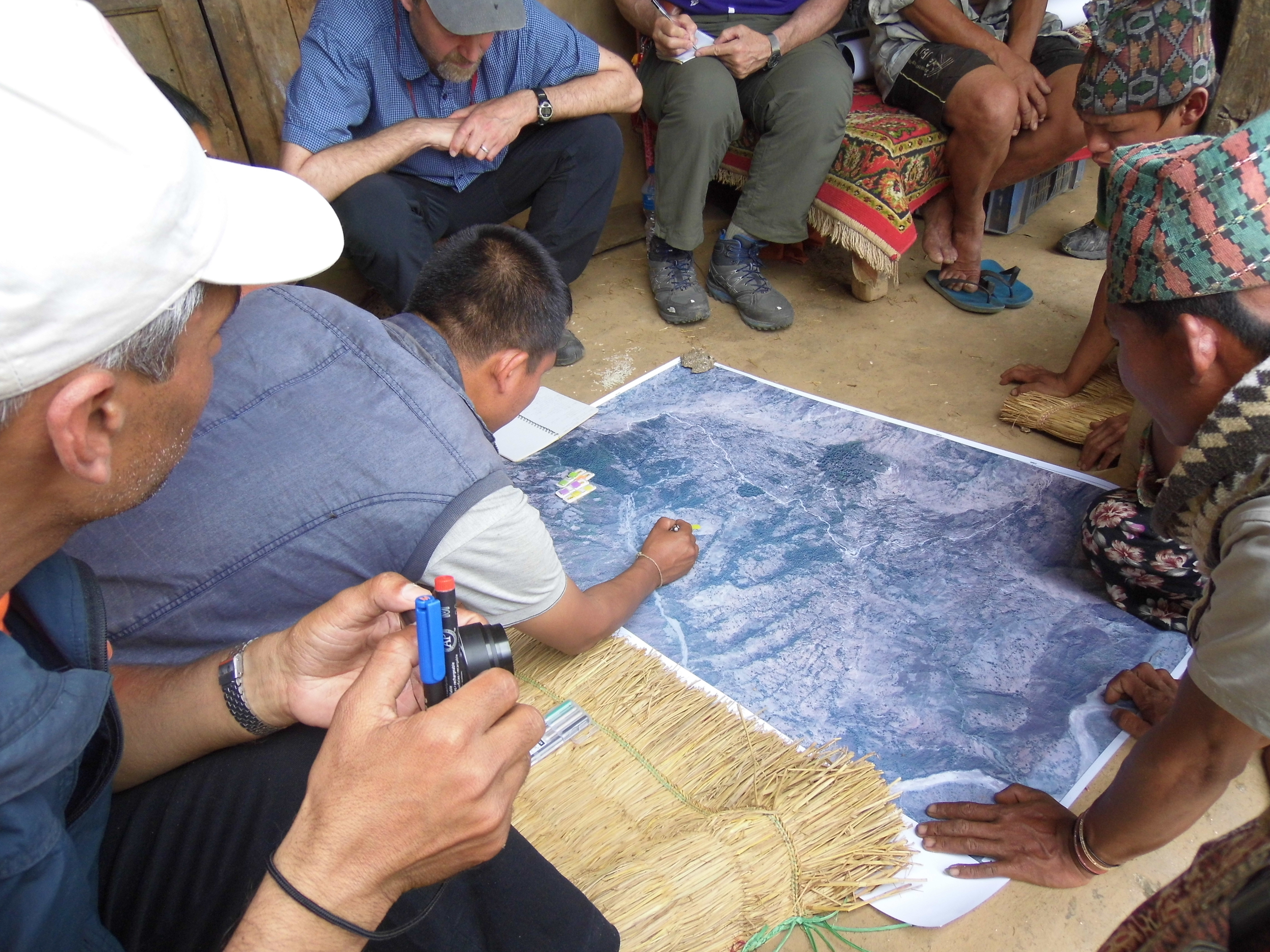
Just over a week ago, in a remote village in Dhankuta District in eastern Nepal, members of the EwF team were exploring with community members the actions that can be taken to make the community safer from earthquakes and their associated secondary hazards, particularly landslides. One activity involved a review of the community’s local disaster risk management plan, which was developed 18 months ago with support from DFID, CARE and local NGO HUSADEC. The EwF team, which includes our collaborators NSET-Nepal, were exploring how EwF could support the community to turn their plan into some concrete activities.
The area where the team was based was not unusual for Nepal: earthquakes were a low priority in comparison to more frequent, everyday hazards. Landslides and rockfalls were a notable problem in two of the wards, as was the problem of pests and diseases which impact the orange and ginger crops and cause the loss of up to 50% of annual cash crop production. Despite these and other livelihood priorities there was still an awareness of earthquake risk. For example, we were told about a boulder that had fallen during the 2011 Sikkim earthquake, landing just meters from the school. However, there was little sense of how villagers might prepare to minimise the impact of an earthquake.
In exploring with the local government and the community the potential role that science could play in community based disaster risk reduction, we acknowledged that stopping the landslides is not an option, but we could look to co-develop a low-tech approach to monitoring the slope to determine the areas likely to slide next. Mapping the boulder fields near the school and other populated areas could inform future planning, to ensure that key infrastructure is constructed in safer areas. With a relatively new road connecting the village with the nearby market town of Hile, the village now has a market for its cash crops which will bring more wealth to the village and, no doubt, the construction of more modern masonry and concrete buildings. To ensure that these new buildings are able to withstand an earthquake, NSET could, subject to funding, provide training in earthquake-safe construction.
So what?
As we look at the images of Nepal following Saturday’s earthquake, it is tempting to see these kinds of community-based initiatives targeting rural resilience as futile. Indeed, they will do little to help the worst-affected communities, for example, in the hill villages in Gorkha and Lamjung Districts in central Nepal. However, in areas that have been more moderately impacted by Saturday’s earthquake, local disaster risk management planning has the potential to make a significant difference to local level resilience. Example actions include: the stock piling of resources for use in emergency situations (this is common place in Nepal as part of the annual monsoon preparedness activities); first aid and light search and rescue training; raising awareness of the warning signs associated with secondary hazards, such as landslides and landslide dams; and the development of local level communication strategies to raise awareness of impending hazards downslope or downstream, so that appropriate actions can be taken. Regardless of the strength of government (which is weak in Nepal) and its ability to respond after a disaster, local capacity is the key to resilience in isolated mountain communities. By institutionalising the local disaster risk management planning process, Nepal is certainly on the right trajectory. It is essential that the Ministry of Federal Affairs and Local Development continues to embed this approach and invests resources in supporting local capacity building to demonstrate its long-term commitment to building a disaster resilient country.