(See Publications tab for published outputs, and the Blogs tab for reports on particular fieldwork expeditions)

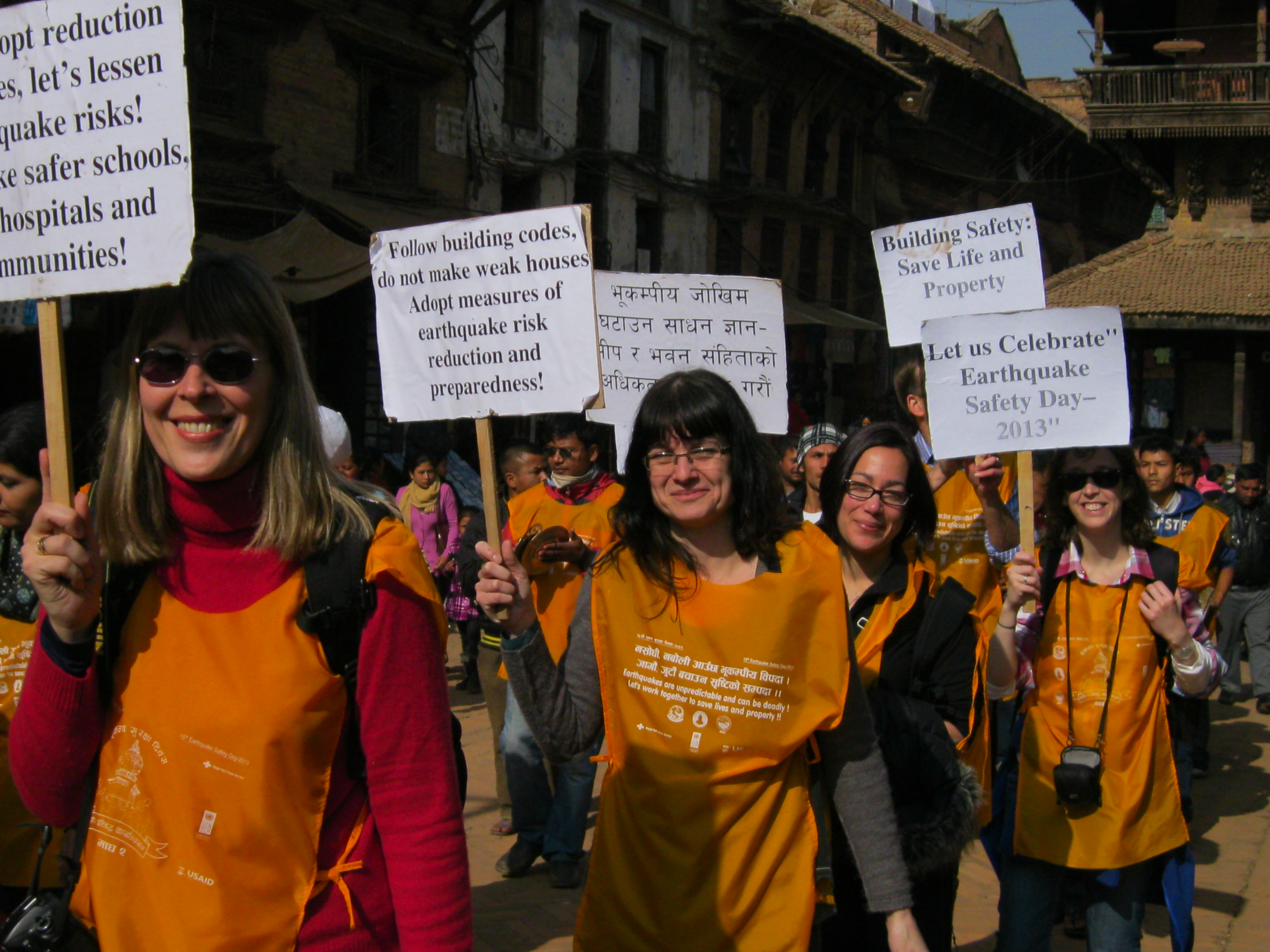
Members of the EwF team participating in the National Earthquake Safety Day in Nepal in Bhaktapur in January 2013.
The Earthquakes without Frontiers project was launched in Nepal and Bihar State in January 2013. The launch events, organised in collaboration with our project partners, brought together more than 50 national level stakeholders involved in earthquake risk reduction in Nepal and Bihar with the aim of refining the research questions so they are relevant to stakeholder needs.
The first phase of the research, in 2013-14, involved:
- mapping out the political context for earthquake risk reduction;
- understanding who the key stakeholders are and the relationships between them;
- a review of the published literature on the state-of-the-art science including tectonics in the Himalayan Region, seismic hazard assessment and landsliding with the aim of identifying research gaps; and
- investigating how science is currently used (or not) and why within policy and practice.
With the aim of ascertaining how science can be used more effectively to inform policy and practice. Preliminary conclusions can be found here.
The second phase of the research (2014-15) focused at the community level. Four to five case study areas (both urban and rural) were identified in collaboration with our local partners for more detailed research. These follow a transect through Nepal and into Bihar State with the aim of capturing different geological and cross-border settings.
Research topics emerging from discussions with stakeholder partners include:
- how to engage urban ‘communities’ in earthquake risk reduction;
- exploring the role of municipalities in the implementation of building codes;
- using participatory risk assessments as a tool for combining local, practitioner and scientific knowledge for resilience building; and
- investigating the constraints and challenges to rolling out local level earthquake risk reduction effectively.
At the same time, we have been investigating patterns of earthquake-triggered landslides, trying to develop a quantitative understanding of how landslide material moves through the landscape after a large earthquake; an activity given particular urgency following the 2015 Gorkha earthquake (below). This phase of the research builds on existing models of slope stability that predict the size and shape of shallow landslides, and that simulate the damaging effects of repeated earthquakes on hillslope materials. We will test our model outputs against compilations of earthquake-triggered landslides from recent events in Pakistan and China.
An EwF meeting was held in Kathmandu in April 2015, 10 days before the Gorkha earthquake. This was a very successful 3-day interaction between EwF researchers and colleagues in NSET (National Society for Earthquake Technology) in Nepal, who hosted the meeting. The event was also attended by collaborators from Bihar State Disaster Management Agency in India and by other principal EwF partners from Iran, China and Kazakhstan. Discussion focussed on the situation in Kathmandu and Nepal/north India and was inspiration for all concerned, and many important new relationships and collaborations were formed. Of course, at the time nobody was aware how imminent was the Gorkha earthquake, which occurred two weeks later.
The Gorkha earthquake of 25 April 2015 has been a major focus of the EwF team since it happened. Activity has been principally in:
- Media engagement, with well over 60 interviews on television and radio and supplied (or wrote) material for media articles
- Advice to UK Government., with several EwF PIs involved in briefing Chief Scientists of the government and DFID on what happened in the mainshock, implications for the humanitarian relief effort, the significance of aftershock activity, and likely activity in the future ─ including the significant possibility that future large earthquakes will occur adjacent to the region affected by the 2015 mainshock is one.

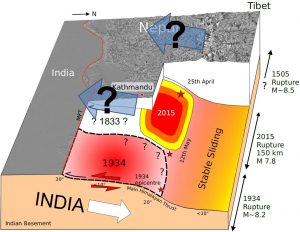
The 2015 Gorkha earthquake only ruptured the lower (10-20 km) part of the Main Himalayan Thrust, on which India slides beneath Nepal, unlike historical earthquakes, such as in 1934, which broke all the way to the surface. The shallower part will eventually move, probably in a future earthquake, and the movement in 2015 has also increased the likelihood of movement to the west of the 2015 earthquake, which last broke in a great earthquake of 1505. A substantial earthquake threat therefore remains. See Elliot et al (2016). Cartoon by John Elliott.
Among the deliverables and consequences were:
- a series of maps of coseismic and postseismic landslides. These were made freely available on the EwF blog, including both maps and the underpinning data files. The data were also distributed widely via the Humanitarian Data Exchange and were shared with MapAction, the UN Logistics Cluster, Nepal Red Cross and the Red Cross. The maps remain the most comprehensive resource on the coseismic landslide pattern, and were the first to differentiate the effects of the 25 April mainshock and 12 May aftershock.
- advice to the UN Resident Coordinator’s office on expected levels of damage in different parts of Nepal, ongoing and anticipated threats in the aftermath of the 25 April and 12 May earthquakes.
- Ongoing work on the landslide hazard is focused on mapping landslides through the 2015 monsoon season (funded by DFID through the SHEAR programme) and assisting the Nepalese to install low-cost strainmeters to monitor fractured hillslopes in the worst-affected areas of Sindhupalchowk and Dolakha districts (part-funded by EwF and by a NERC urgency grant to Durham University).
- EwF participated in a comprehensive review of the earthquake response coordinated by project partner BSDMA in India.
- The EwF team made extensive use of Twitter in the aftermath of the earthquake, both for publicising outputs of the project (such as the landslide maps and data) and for sharing and promoting useful information. We became widely recognised as a reliable source of information on the earthquake, and more than doubled our number of followers.
- New grants for research on monitoring earthquakes and strain in Nepal. EwF scientists’ existing knowledge of Nepal, and rapid access to GPS and local seismicity data, put them in a strong position to provide advice to the UK government. It was clear soon after the Gurkha earthquake that the event was smaller than had been anticipated and was insufficient to release the strain we know has accumulated since the last big earthquake in 1934. The pressing question is what will happen next (and when). There is a clear need to monitor the post-earthquake seismicity and GPS motions, which we have continued to do, with help from grants from DFID and NERC.
- More information is available in the posted blogs http://ewf.nerc.ac.uk/blog/


